Canal Walk Pumerend
During the Canal Walk you walk along the existing and filled in canals of Purmerend. Along the way you will learn about the history of this once water-rich city.
Located right in between the Purmer, Beemster and Wormer lakes, before the reclamaton, Purmerend has had many different functions over the centuries. The prosperity of the past is reflected in beautiful architectural styles and idyllic streets. Don't forget to look around you! Do you see the traces that history has left behind? The vistas? And the connection between old and new?
Route
This route can be followed via the yellow arrows that can be found on lampposts, traffic posts or route posts and show you the way along the route. The route starts and ends at the TOP (Tourist Transfer Point) on the Beemsterburgwal.
Useful information
The free brochure with routemap is available at the VVV Museum Shop.
Dit ga je zien
Startpunt
TOP Purmerend
Beemsterburgwal
1441 KB Purmerend
Navigeer naar startpunt
Tourist Transfer Point (TOP) Purmerend
TOPs are Tourist Transfer Points. You can park your car at each TOP and then discover the rural surroundings by bike, on foot or by boat.
Tourist Transfer Point (TOP) Purmerend
TOPs are Tourist Transfer Points. You can park your car at each TOP and then discover the rural surroundings by bike, on foot or by boat.
TOP Purmerend is located on the edge of the city center, on the Beemsterburgwal. Purmerend's cycling, walking and boating network come together here, making it the perfect base from which to discover the unique and beautiful locations in Purmerend and the surrounding area.
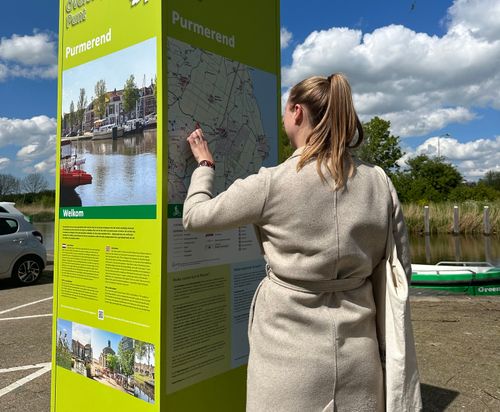
At each TOP you will find routes on the information column that introduce you to the most beautiful places, the tranquility and nature in Laag Holland. Along the way, there are rest stops and catering establishments at surprising locations. The TOPs will help you find them. The TOPs can be recognized by the green information columns.
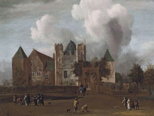
Information panel | Slot Purmersteijn | Slotplein
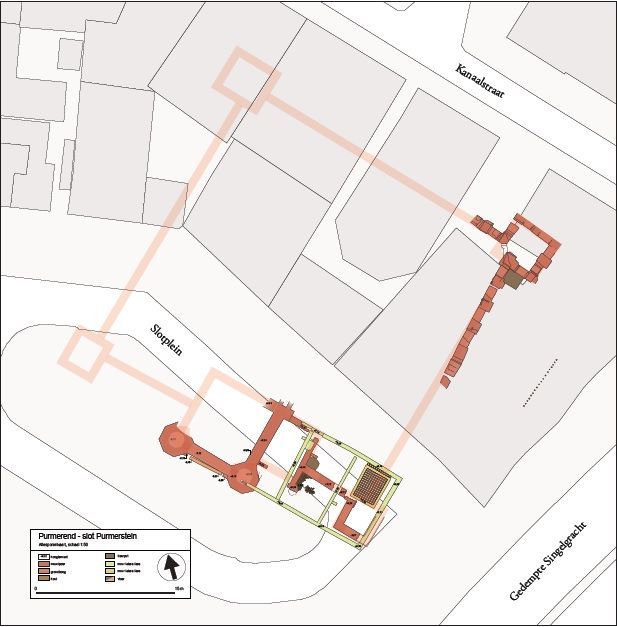
The Slotplein is an important, historic place for Purmerend. There is not much left to see now, but this used to be the location of an enormous castle, with large donjons on the corners and huge halls. Even bigger than the Muiderslot!
Information panel | Slot Purmersteijn | Slotplein
The Slotplein is an important, historic place for Purmerend. There is not much left to see now, but this used to be the location of an enormous castle, with large donjons on the corners and huge halls. Even bigger than the Muiderslot!
The important administrative and military center Slot Purmersteijn was built in 1410 by the wealthy banker Willem Eggert. As treasurer of Holland and Zeeland, he was one of the most powerful men in the county. He used his power to tackle fraud and bribery within the Dutch nobility. Under his leadership, West Friesland, Texel and the Kop van Noord-Holland were liberated from the tyranny of the nobles and most villages became self-governing.
Eggerts actions were not appreciated by the nobles. During his life he received many angry letters from the Dutch nobility. After his death, his family was rejected by this group. Because of this, the name Eggert has no further relevance in Purmerend history. The castle also came back into the hands of the noble families, who left the management entirely to a castellan. Over the centuries, Slot Purmersteijn became a hated symbol of the power of the castellan and in particular the Prince of Orange. When the opportunity presented itself, the regents of Purmerend demolished the castle in 1741.
On the castle square, where the entrance to the castle was originally, you will only find a replica of a part of the castle wall.
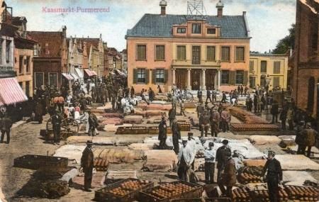
Information panel | Kaasmarkt (Cheese Market)
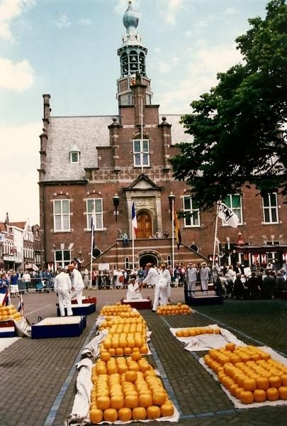
The Kaasmarkt in Purmerend has a market history of more than 600 years. The first small-scale market was held here in 1484, when it was still called Marktveld and was no more than a small square.
Information panel | Kaasmarkt (Cheese Market)
The Kaasmarkt in Purmerend has a market history of more than 600 years. The first small-scale market was held here in 1484, when it was still called Marktveld and was no more than a small square.
After the reclamation of De Beemster in the early 17th century, the market really started to grow. In order to cope with this growth, a number of things were reorganized in the city. The cattle market was moved to the old Kloosterwerf (now the Koemarkt). The square itself also changed. A few buildings were demolished to make room, the town hall was set back 10 meters, the main church was demolished and even the graveyard was closed and paved for market trade.
Eventually all markets were spread over the city and only cheese was traded on the Kaasmarkt. Up to four million kilos yearly! The Purmerend cheese market was the second largest cheese market in the Netherlands, after Alkmaar. Nevertheless, the Purmerend cheese market was more innovative. In Alkmaar the cheeses were still transported to the Waag on barrows carried by cheese carriers, in Purmerend cheese trays with a set of wheels were used. The backs of the cheese carriers lasted longer in Purmerend!
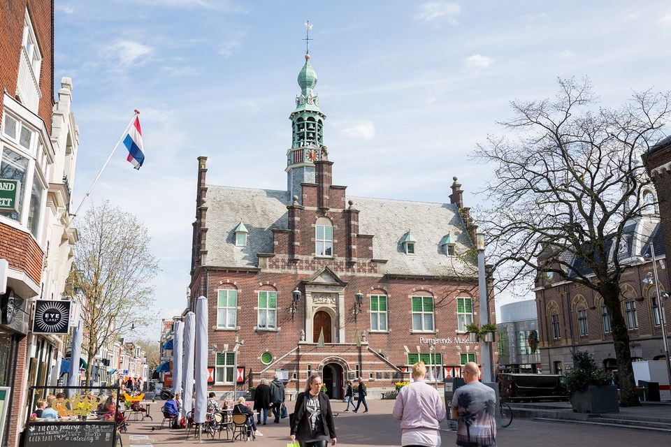
In the mid-20th century, the industrialization of the dairy industry won the battle over the traditional cheese market. Shortly before 1940, the very last cheese market was held in Purmerend. The success of this has certainly contributed to Purmerend's status as the market town of North Holland. A visit to the Cheese Market is still worth it. You will find terraces, the Nicholas Church and the imposing Purmerends Museum in the old town hall.
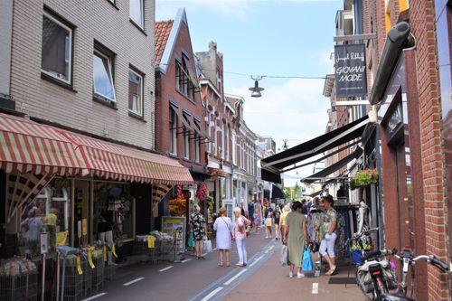
Padjedijk
Until the end of the 19th century, Purmerend consisted almost exclusively of canals. Many of these canals have been filled in to make way for modern means of transport.
Padjedijk
Until the end of the 19th century, Purmerend consisted almost exclusively of canals. Many of these canals have been filled in to make way for modern means of transport.
You can still find many references to the time when only a few dykes ran through the center and the boat was the main means of transport. Just look at the nameplates in the city. The Padjedijk (the path to the dyke) is an example of this.
Information panel | Necker-Poort | Neckerdijk
The Neckerpoort (Neck Gate) is one of the five former gates of the old city of Purmerend.
Information panel | Necker-Poort | Neckerdijk
The Neckerpoort (Neck Gate) is one of the five former gates of the old city of Purmerend.
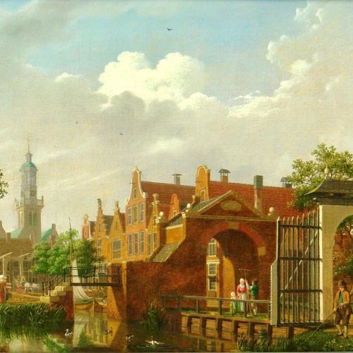
When Purmerend received city status in 1410, earthen walls were built around the city to keep out any potential enemies. Initially, four city gates were built, but after the reclamation of the Beemster a fifth was added. Anyone who wanted to enter the city came through one of these gates, after paying the gate fee of course.
The old wooden Neckerpoort was later replaced by a stone one. However, the gate was demolished in 1818 to make room for the Noordhollandsch Kanaal (North Holland Canal). In 2013, the Nieuwe Neckerpoort was built opposite the location of the old gate, where a fine catering facility offers a recognizable image of the inns that used to be built around the city gates.
Painted panels
Look at the panels on the building on the corner of the Nieuwstraat and the Gouw. These panels show a piece of Purmerend’s history.
Painted panels
Look at the panels on the building on the corner of the Nieuwstraat and the Gouw. These panels show a piece of Purmerend’s history.
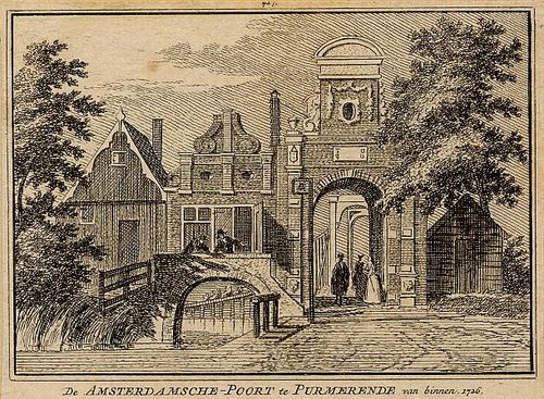
Information panel | Amsterdamsche-Poort | Tramplein
If you look for the tram on Tramplein, you will be disappointed. The name comes from the time when the steam tram from Amsterdam to Alkmaar ran along Purmerend.
Information panel | Amsterdamsche-Poort | Tramplein
If you look for the tram on Tramplein, you will be disappointed. The name comes from the time when the steam tram from Amsterdam to Alkmaar ran along Purmerend.
At the time, you could quickly reach the city center from the Tramplein via one of the city gates. You used to find the Amsterdamsche Poort (Amsterdam Gate) here, one of the city gates of Purmerend, on the access road to and from Amsterdam. So strange to think that the city was actually locked at night about 100 years ago! The Tramplein is now a bus station and still provides a fast connection to the neighboring cities. The current station dates from 2014. The facade of the building has glass panels with historical images of Purmerend.
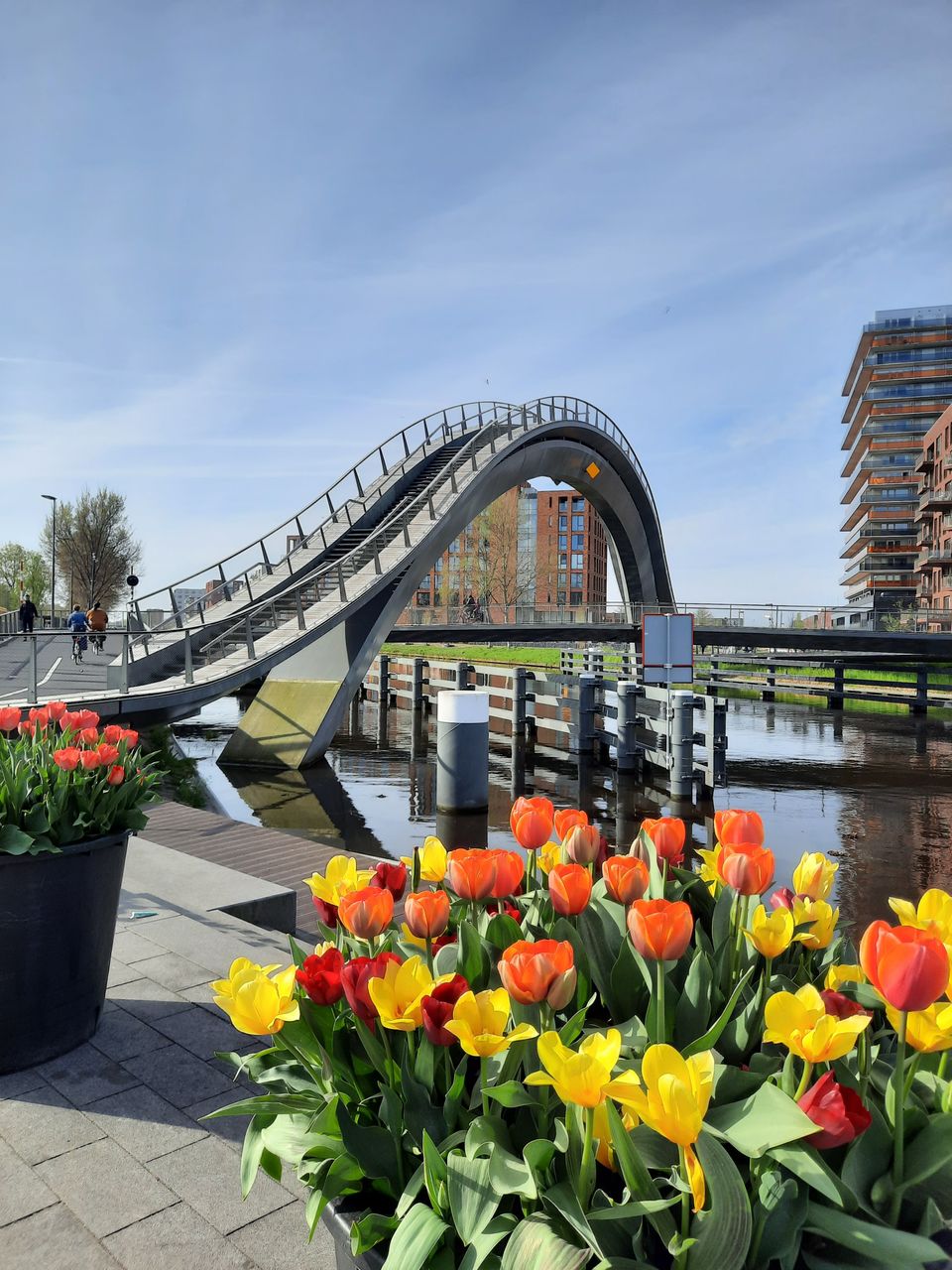
After 1900, the first buildings were constructed outside the city moat. This started with a post office, but soon whole new neighborhoods followed. The newest expansion of the city can be found on the other side of the legendary 'Melkwegbrug' (Milky Way Bridge). This bicycle and pedestrian bridge connects the old Purmerend with the largest residential area of the city 'Weidevenne'.
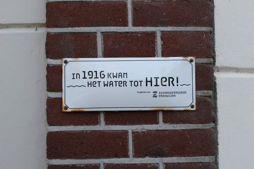
Watermark 1916
When you live below sea level, it’s bound to go wrong at some point. In 1916, a major dyke breach south of Volendam put Purmerend under water for more than six weeks.
Watermark 1916
When you live below sea level, it’s bound to go wrong at some point. In 1916, a major dyke breach south of Volendam put Purmerend under water for more than six weeks.
Do you want to know how high the water was in the winter of 1916? The mark on the building on the corner of Tramplein and Herengracht shows the water level at the time of the flood.
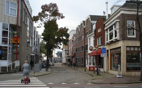
Historic streets
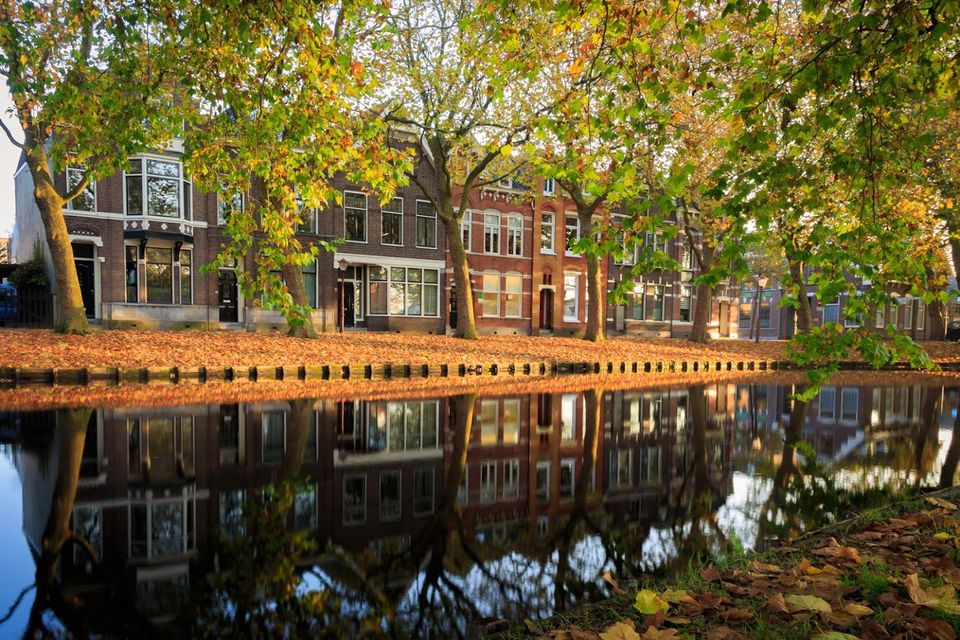
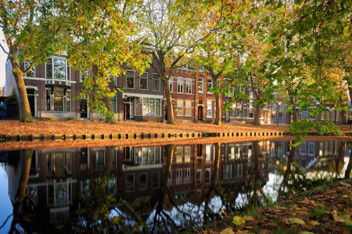
The townhouses built on the Herengracht, Emmakade, Julianastraat, and others, ooze class and prosperity and were very special in the early 20th century.
Historic streets
The townhouses built on the Herengracht, Emmakade, Julianastraat, and others, ooze class and prosperity and were very special in the early 20th century.
This part of Purmerend was the first 'new' housing estate outside the city canal. A large part of these beautiful buildings are now national monuments. Do you want to know which these are? Have a look at the signs on the facades or view the Atlas of the Municipality of Purmerend.
On the Herengracht you will find, among others, the villas Schoonoord and Maria, both designed by architect Jan Stuyt. The former Liduina hospital (1950-1988), also designed by Stuyt, is located on the Emmakade. It was originally built in 1911 as a Roman Catholic home for the elderly and was later converted into apartments. The blockhouse at 9 Julianastraat was delivered at the time as a ready-to-build kit from Silesia, Poland and was originally a residence for the then mayor. Architect J.J.P. Oud designed the four workers' houses at Vooruitstraat 143 to 149, as well as the Wilhelminalaan 10 building. The original function of the latter building was an association building of the Werkmansvereniging Vooruit.
Information panel | Bastion | Wolthuissingel
The Bastion, or stronghold, was built in 1645 in order to strengthen the defenses of the city.
Information panel | Bastion | Wolthuissingel
The Bastion, or stronghold, was built in 1645 in order to strengthen the defenses of the city.
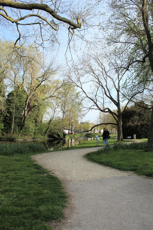
Here, you can still see the shape of this old stronghold, which consisted of a ring of canals and moats, and an earthen wall.
The earthen walls have given way to green gardens, but the canals are still clearly visible.
Information panel | Purmer-Poort | Looiersplein
When Purmerend received city status in 1410, ramparts were built around the city and four gates were built on the access roads. These gates were closed at night, making living within the city a lot safer.
Information panel | Purmer-Poort | Looiersplein
When Purmerend received city status in 1410, ramparts were built around the city and four gates were built on the access roads. These gates were closed at night, making living within the city a lot safer.
Anyone wishing to enter the city had to report to the city gate. In this way it was possible to keep evil types, vagabonds and exiles (criminals who were banished as punishment) out of the city.
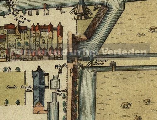
The eastern entrance gate was built in 1594 and stood at the end of the Koemarkt near the Looiersplein. This gate was called the Purmerpoort (Purmer Gate) because the road behind it, the Purmersteenweg, led to the Purmermeer (Purmer Lake). This gate was built in 1594 and was the last gate to be demolished in 1859. The gate was replaced by two gatehouses, between which an iron gate stood so that the city could still be closed off. The gatehouses disappeared from the townscape around 1900.
The Looiersplein (Tanner Square) owes its name to the fact that a tannery stood here until 1878.
Koemarkt (Cattle Market)
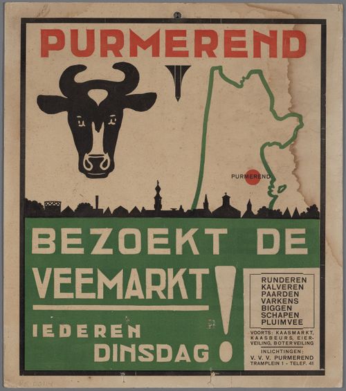
Until the eighties of the last century, Purmerend was a bustling 'Market City'. Every week, the Koemarkt would be full of cattle, ready to be sold.
Koemarkt (Cattle Market)
Until the eighties of the last century, Purmerend was a bustling 'Market City'. Every week, the Koemarkt would be full of cattle, ready to be sold.
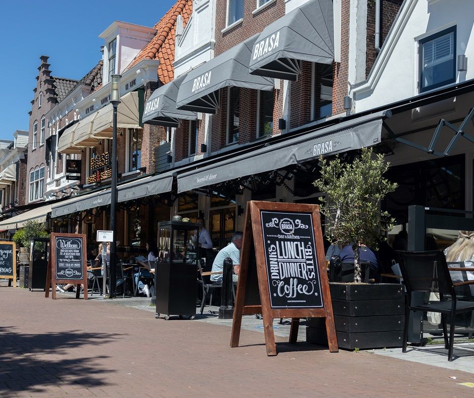
But there was much more to do than just cattle trade. How about cheese, fish, sheep and pigs? For each product group, a specific square was allocated in the city, which made for a lively city centre. Tuesday is still market day in Purmerend. The cattle markets are now a thing of the past and that is why the Koemarkt has been given a new use. The Koemarkt has become a centre for gastronomy, with cozy cafes and nice restaurants. Many events also take place here. All of this makes the Koemarkt the 'living room' of the region!
Take a good look at the pavement of the square. Here is another reminder of the earliest history of Purmerend: five stone plaques depicting the history of the Saint Ursula Monastery that was founded on this site in 1392.
Information panel | Hoornsche-Poort | Hoornselaan
The Hoornsche Poort (Hoorn Gate) was the oldest of the city gates that were built around Purmerend after obtaining city status in 1410.
Information panel | Hoornsche-Poort | Hoornselaan
The Hoornsche Poort (Hoorn Gate) was the oldest of the city gates that were built around Purmerend after obtaining city status in 1410.
The name already gives it away; the Hoornsche Poort guarded the north of the city on the way to and from Hoorn. Anyone who wanted to enter Purmerend from the footpath over the Overweerse Polderdijk had to pay gate or market fees. This was a lucrative source of income for the city. Before the reclamation of the Beemster and Purmer, travelers between Hoorn and Amsterdam could not bypass Purmerend by land.
During a period of peace after French rule, gates and defenses were quickly seen as redundant. No maintenance was done and many gates fell into disrepair. The Hoornsche gate was demolished in 1838. On the spot where this gate once stood, you can now walk along the Where and see the beautiful harbor of Purmerend.
Overweersepolderdijk cemetery
On the Overweersepolderdijk in Purmerend you will find a historic cemetery from 1875 with a chapel from 1878.
Overweersepolderdijk cemetery
On the Overweersepolderdijk in Purmerend you will find a historic cemetery from 1875 with a chapel from 1878.
In the summer months, various activities are organized here, such as exhibitions in the chapel from Friday to Sunday from 13:00 - 16:00. In addition, the cemetery is a beautiful quiet area in Purmerend with a number of monuments and statues. It can be visited daily all year round from 10:00 - 17:00.

Double street name
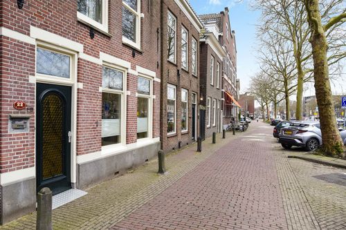
This is a street that has two names: One half of the street is called Bierkade, the other half is called Venediën.
Double street name
This is a street that has two names: One half of the street is called Bierkade, the other half is called Venediën.
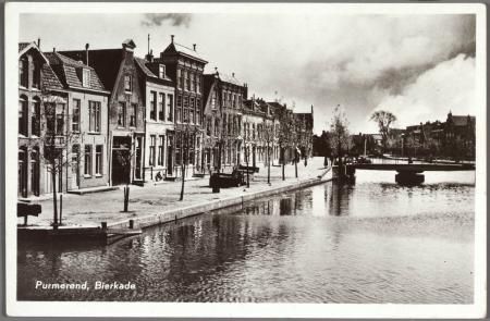
The Bierkade (Beer Quay) is the place where beer merchants from Haarlem owned various buildings and brought the beer ashore from their ships. The beer was stored in these beautiful historic buildings and distributed throughout the region. At the time, drinking beer was safer than water and therefore very popular. However, beer was also expensive, so it was a lucrative trade. These buildings were later bought by notables, resulting in the beautiful characteristic and elegant houses that we can still admire today. A large part of these buildings are national monuments. Do you want to know which ones? Have a look at the Atlas of the municipality of Purmerend.
Beer has never left Purmerend. Nowadays you can enjoy delicious beers in the cafes on the Koemarkt and the city still has its own brewery! Halfway through the Bierkade, the street name changes to Venediën. In the past, this part, which at the time was still on the water, looked a lot like the Italian Venice.
Vismarkt (Fish Market)
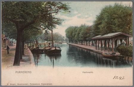
When you say Purmerend, you will most likely think of the Koemarkt and the cattle trade. However, until about 1880 Purmerend was mainly known for fishing and the sale of Purmer eel.
Vismarkt (Fish Market)
When you say Purmerend, you will most likely think of the Koemarkt and the cattle trade. However, until about 1880 Purmerend was mainly known for fishing and the sale of Purmer eel.
At that time, Purmerend was located between the not yet reclaimed Beemster, Purmer and Wormer lakes.
The eel caught here in the Where and on the Beemster lake were of very good quality and in great demand. The 'Purmer Ale' (Purmer eel) pamphlets hung on the walls as far as London. The eel was brought to London alive and well in ships with open keels. Here, the city of Purmerend had its own fish auction on the banks of the Thames, where the eel brought in good money.
Of course not all fish went to London, a lot was sold here in Purmerend. Where you are standing nowi s now called the Oude Vismarkt (the Old Fishmarket), the eel was sold here at the fish auction. After the reclamation of the lakes, Purmerend's eel fishing industry was lost. The fish market remained, although in a slimmed-down form. Until about 1880 the fish market on the current Oude Vismarkt was maintained for the sale of fresh fish. After 1880, the fish market moved to the Venediën, opposite the Catholic school. In 1933 the fish market, the oldest market in the city, was closed.
Information panel | Beemster-Poort | Beemsterburgwal
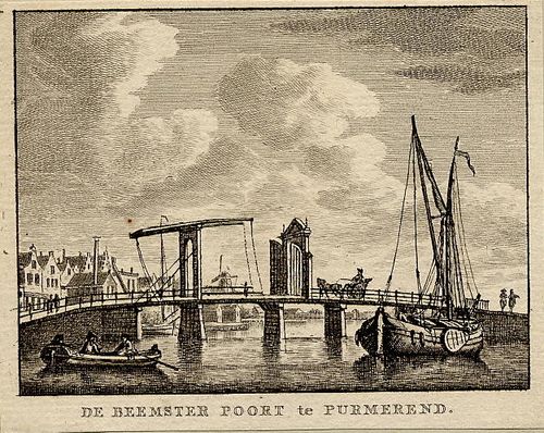
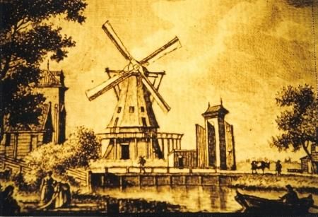
The Beemster-Poort (Beemster Gate) was the fifth and last city gate to be built around Purmerend.
Information panel | Beemster-Poort | Beemsterburgwal
The Beemster-Poort (Beemster Gate) was the fifth and last city gate to be built around Purmerend.
The first four gates were built after obtaining city status in 1410. The need for a fifth gate arose after the reclamation of the Beemster in 1612. A simple wooden gate was built on the bridge from the city to the newly acquired land: The Beemster Gate. When De Beemster was reclaimed and the roads were passable, this route was used to move towards Oosthuizen and Hoorn. As a result, the access road through the Hoornsche Poort was hardly used anymore.
During a period of peace, the city walls and city gates became redundant as defense works. If an enemy did arrive, the retractable bridges could be used to protect the city. Between 1830 and 1840, all gates in Purmerend, with the exception of the Amsterdamsche Poort, were demolished.
